Updated Aerial Imagery

We’re excited to announce that ThinkGeo Cloud has been updated with the most recent National Agriculture Imagery Program (NAIP) aerial imagery, giving your maps sharper detail and more up-to-date views of the landscape across the United States.
From agriculture and land management to infrastructure and urban planning, aerial imagery provides essential context. With the latest NAIP data now integrated into ThinkGeo Cloud, you’ll benefit from:
Up-to-date coverage -This ensures that your application remains accurate, relevant and serving the needs of your users.
Higher resolution - Previously, all U.S. states were delivered at 1-meter resolution. With this update, imagery improves to 0.3 meters in 16 states - including Alabama, Arkansas, Arizona, Connecticut, Delaware, Florida, Iowa, Illinois, Massachusetts, Maryland, Minnesota, New Hampshire, New Jersey, Ohio, Rhode Island and Vermont - while all other contiguous states are now available at 0.6 meters.
Nationwide consistency - Seamless imagery across the continental United States.
Easy access - Stream NAIP imagery directly through ThinkGeo Cloud APIs without having to manage raw datasets.
Whether you’re building desktop, web, or mobile applications, ThinkGeo Cloud ensures that you and your users have the most current imagery at your fingertips.

Figure 1: Satellite Imagery from Downtown Minneapolis. The left side shows the older 1 meter resolution and the right side is the updated 0.3m resolution.
Tip
To get your own ThinkGeo Cloud api keys, sign up here you will receive an email with your api keys and links to the Cloud Quickstart Guide.
See It In Action!
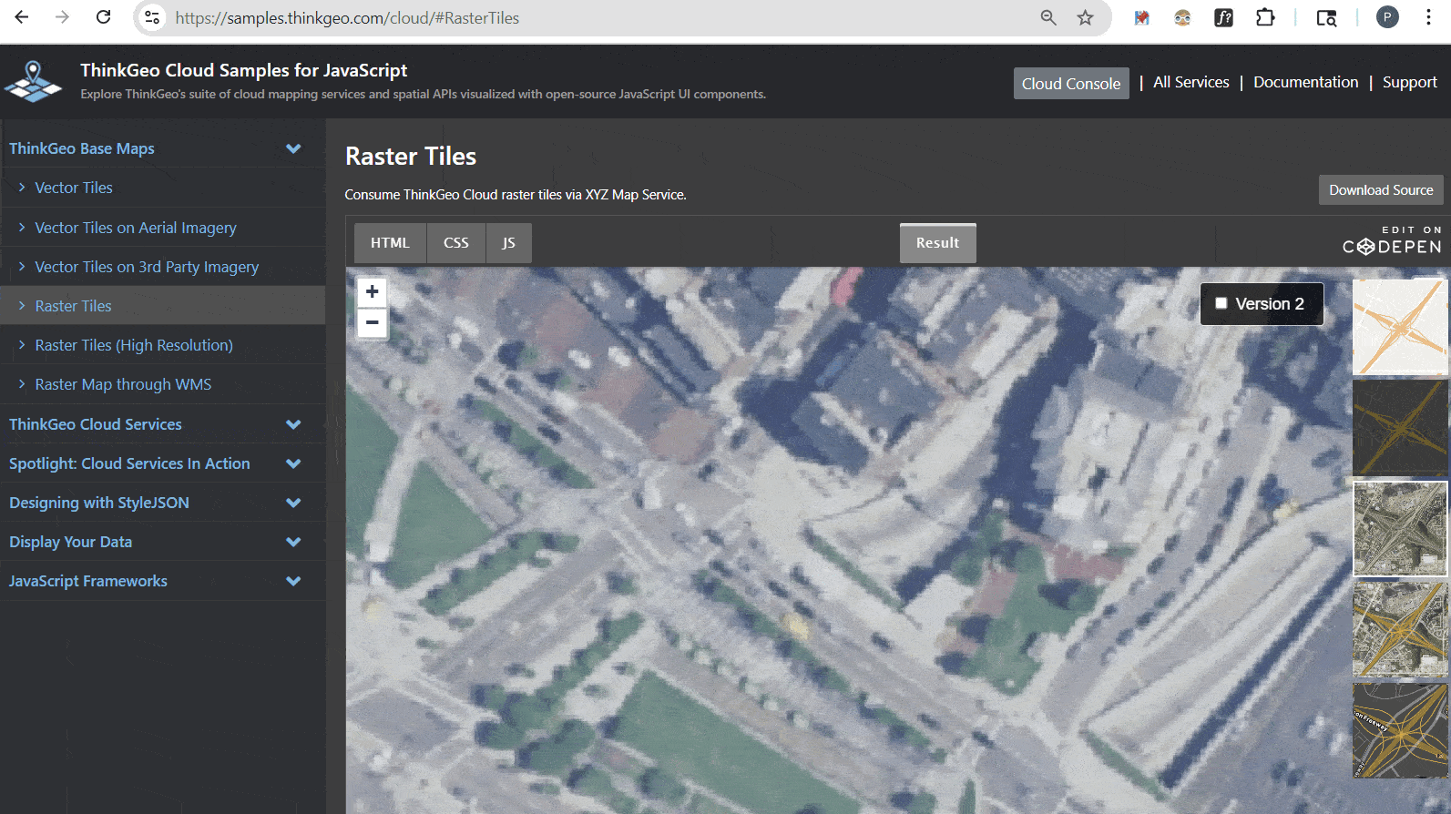
Figure 2: The ‘Raster Tiles’ cloud sample allows you to compare the different versions of NAIP imagery for your specific area.
The simplest way to see the new NAIP imagery in action is to check out maps.thinkgeo.com, zoom into your local area and switch to ‘aerial’ or ‘hybrid’ using the icon in the lower right corner.
If you want to compare the older aerial imagery with the latest, just go to our Raster Tiles online sample, click on the aerial or hybrid tiles on the right side and then toggle the ‘Version 2’ checkbox to see the improvements. You can also see this comparison here in Figure 2.
Samples and Code Walkthrough
You can quickly explore the online samples above, but most developers prefer to look under the hood and see the code. Check out the links below to see how to use the new aerial imagery in your applications:
Javascript API Sample Code and Quickstarts - Gitlab repo where you can download sample code for accessing cloud functionality via the Javascript API and view Quickstart guides.
.NET API Sample Code and Quickstarts - Gitlab repo where you can download sample code for accessing cloud functionality via the .NET API and view Quickstart guides.
REST API Swagger Docs - If you want to use the REST api to work directly with ThinkGeo cloud, the Swagger docs are your first stop to see documentation on all the api calls and parameters. There’s even a handy ‘Try it out’ button on each endpoint that allows you to test with your own data. You can also use a tool like Postman or any programming language to directly call the REST api endpoints.
In order to maintain backwards compatibility, you will need to change your Map Type from ‘aerial’ to ‘aerial2’ to use the new imagery. Note: If you’re using a hybrid basemap, just change from ‘hybrid’ to ‘hybrid2’.
On the Desktop, Mobile or Web, just adjust your code to use the new aerial2 and hybrid2 values in the ThinkGeoCloudRasterMapsMapType enumeration. If you’re working with our Javascript API or REST API, then it’s just the url that needs changed - it’s that simple.
Summary
We hope today’s post has been helpful. If you have any questions or if you have a topic you would like to learn more about, please email sales@thinkgeo.com or schedule a meeting to talk in person.
About ThinkGeo
We are a GIS software company founded in 2004 and located in Frisco, TX. Our clients are in more than 40 industries including agriculture, energy, transportation, government, engineering, IT, and defense. We pride ourselves on our excellent service and transparency. ThinkGeo offers a variety of products and services to meet almost any GIS application need. We can even help you develop your next project - anywhere from a few hours of consulting to outsourcing an entire project. To learn more, email us at sales@thinkgeo.com, or call us direct at 1-214-449-0330.