
Introducing GPU Rendering and 3D Maps in ThinkGeo Beta 15
Today we’re proud to announce ThinkGeo Beta 15 which introduces GPU-accelerated rendering with support for interactive 3D vector and raster maps.
Check out the short 1-minute introduction below:
GPU-Accelerated Rendering
Beta 15 brings a new GPU-based rendering engine designed to offload much of the visual rendering work from the CPU to the graphics processor. This allows ThinkGeo to render complex vector and raster maps more efficiently while providing smoother interaction during panning, zooming, rotation, and tilt.
The new renderer also changes what is possible visually. Vector features, raster imagery, labels, and terrain can all participate in the same GPU-rendered map, making capabilities such as perspective views, extruded buildings, and elevation-based terrain practical within a standard ThinkGeo desktop application.
3D Vector and Raster Maps
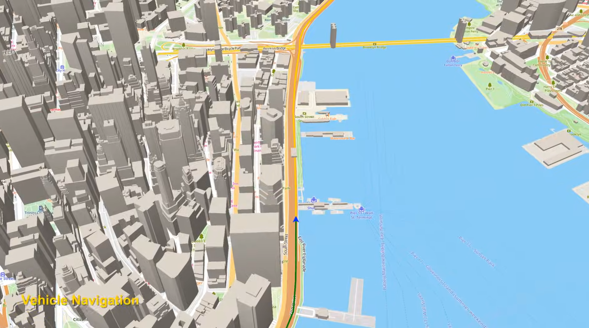
The ‘Vehicle Navigation’ sample from the HowDoI samples.
Maps are no longer limited to a traditional top-down view.
Developers can now create perspective maps that users can tilt, rotate, and explore interactively.
Vector features can be rendered in 3D, including extruded polygons such as buildings, while raster imagery and basemaps can be viewed in the same perspective environment.
Terrain and Elevation
Beta 15 also supports true terrain visualization using elevation data.
Raster imagery can be draped over an elevation surface to create a 3D representation of the landscape, while vector features can be displayed together with the terrain.
ThinkGeo applications can also access the underlying elevation data for features such as elevation queries and profiles.
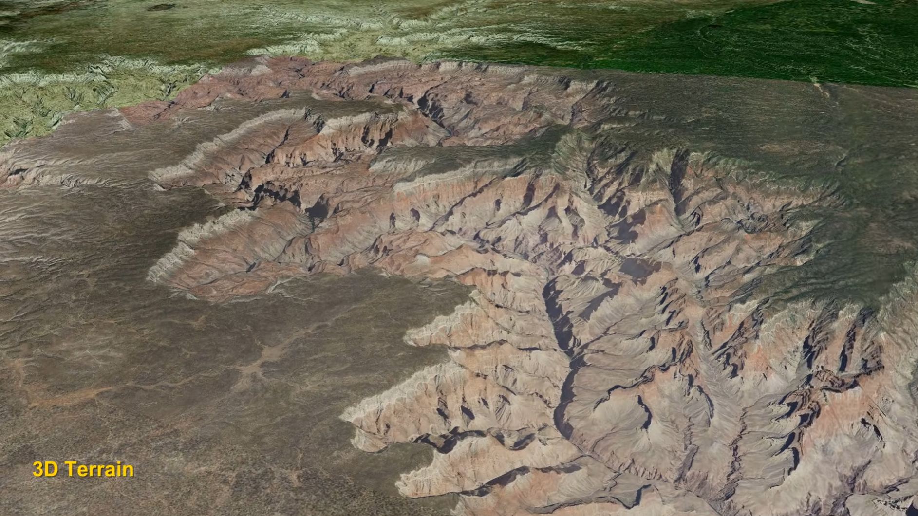
3D Raster Terrain using DEM model from the ‘HowDoI’ samples.
Try It Out!
Download and run the new Beta 15 WPF HowDoI samples:
ThinkGeo Beta 15 HowDoI Samples
GPU rendering and 3D support are still in beta, and we welcome feedback as we continue expanding these capabilities. Stay tuned for the full ThinkGeo 15 release later this fall.
Connect With Us
We hope you found today’s post useful. Please contact us if you have feedback or questions on the new endpoints. Email us at support@thinkgeo.com or schedule a meeting to talk in person. We always enjoy connecting with our customers, learning how you’re using ThinkGeo, and exploring new ways to improve our products.
About ThinkGeo

We are a GIS software company founded in 2004 and located in Frisco, TX. Our clients are in more than 40 industries including agriculture, energy, transportation, government, engineering, IT, and defense.
We pride ourselves on our excellent service and transparency. ThinkGeo offers a variety of products and services to meet almost any GIS application need. We can even help you develop your next project - anywhere from a few hours of consulting to outsourcing an entire project. To learn more, email us at sales@thinkgeo.com, or call us direct at 1-214-449-0330.
