Routing and Service Area Functionality Comes To The ThinkGeo Cloud
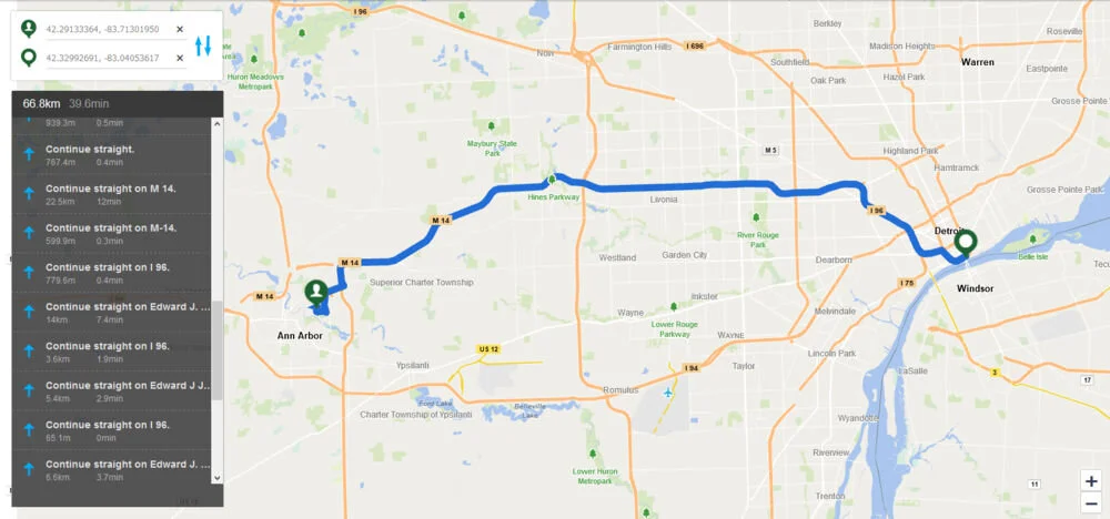
ThinkGeo’s next addition to its robust cloud offering is ThinkGeo Routing, and it’s already here! Not only can you now get driving routes and turn-by-turn directions from our cloud, we also added a Service Area utility to help you manage business logistics using spatial analysis.
Cloud customers and evaluators are now able to enter in start/end coordinates and receive the shortest driving route back to them. In addition, our ThinkGeo Cloud Routing service supports routing through up to 25 waypoints if you need to find the best route between a list of locations. In combination with our Cloud Geocoder, you can route from any address to another with equal ease.
At launch, our Cloud Routing service offers driving routes for North America (including the United States, Canada and Mexico) and select Central American countries (Belize, Cuba, Guatemala, Haiti, Dominican Republic, Jamaica, and Nicaragua). Global routing will be offered later on in the year.
You can go hands-on with our Routing functionality right now at our ThinkGeo Demo Center, or start your free 60-Day ThinkGeo Cloud evaluation and integrate it into your own project today!
The second addition to ThinkGeo Cloud is the Service Area endpoint. This is an isochrone utility that can calculate what is reachable within a configurable time or distance from any starting location in North America. It’s quite simple, actually: just pick your starting location, set your time or distance parameters, and then our API will render the areas you can reach with color-coded shading to show you where and how fast you can get there. This API can be used for everything from emergency vehicle dispatching to locating all of the pizza places within 10 minutes of your home and so much more.
Test-drive our Service Area API right now at our ThinkGeo Demo Center site or start your free 60-Day ThinkGeo Cloud evaluation and start calculating isochrones for your own project.
There will be several enhancements and new features added to both new services in the weeks to come, and we can’t wait to share them with you!


