
ThinkGeo 15.0 is our largest release yet. It introduces a new GPU-accelerated rendering engine, 3D terrain and buildings, advanced data visualization, and a redesigned developer licensing system.
The full changelog for each product can be found using the links below:
GPU-Accelerated Map Rendering
ThinkGeo 15 introduces an entirely new GPU rendering engine for WPF and WinForms applications. Built for .NET 8 and later, the engine uses hardware acceleration to deliver smoother navigation, faster map rendering, and improved visual quality.
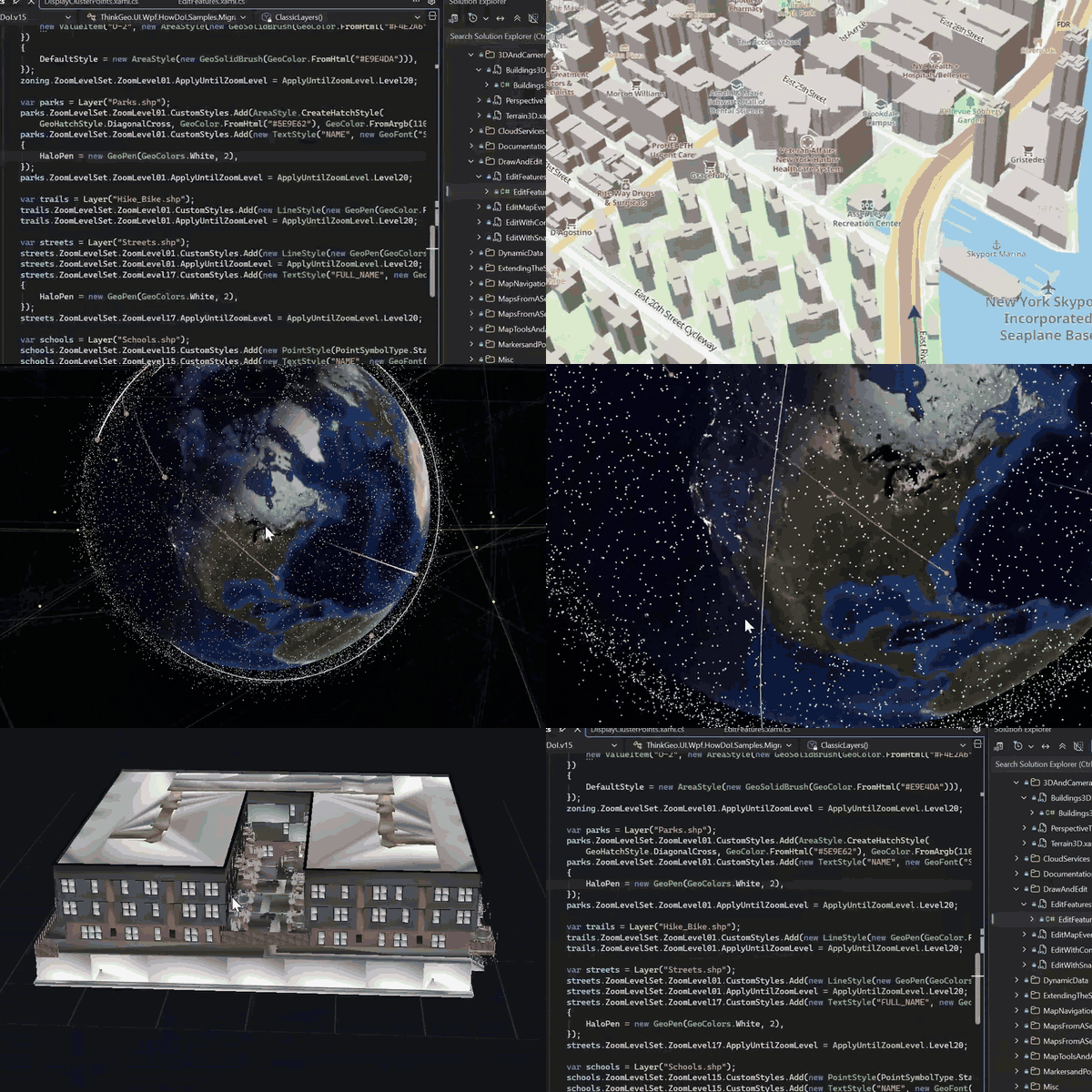
Real captures from applications built using ThinkGeo v15.x
The new engine handles complex vector maps, labels, and visual effects more efficiently while continuing to support existing ThinkGeo map overlays.
Developers can choose between the traditional rendering engine and the new GPU renderer, making it possible to adopt the new technology without rewriting an entire application.
More details can be found on this blog post, and the latest HowDoI samples demonstrating the new features can be pulled from here.
3D Terrain and Buildings
ThinkGeo 15 brings native 3D mapping to Windows desktop applications.
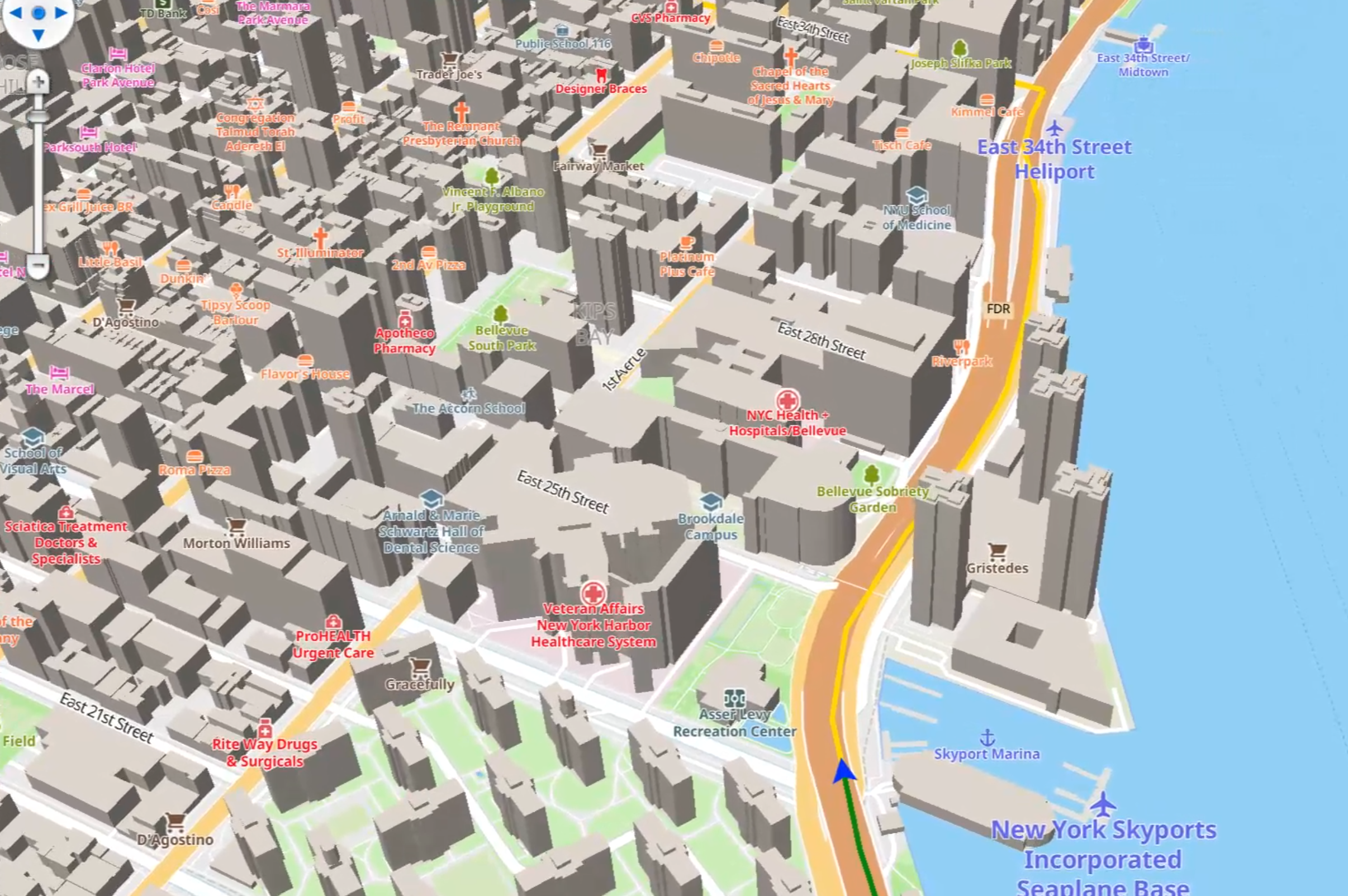
Maps can now display elevation-based terrain, hillshading, and extruded 3D buildings. Users can tilt and rotate the map to explore geographic features from different perspectives.
The engine supports digital elevation models (DEMs), adjustable terrain exaggeration, and building heights. Developers can also retrieve elevation values and profiles directly from the map.
These capabilities open up new possibilities for applications involving urban planning, forestry, infrastructure, environmental modeling, and other 3D GIS workflows.
A New Developer Licensing Model

ThinkGeo Helpdesk - your one stop for all support and licensing questions.
We've redesigned ThinkGeo licensing to better support modern development workflows, including AI-assisted coding, automated builds, and developers working across multiple machines.
Previously, ThinkGeo licenses were tied to individual development machines and checked when running under a debugger. In version 15, licenses are assigned to developers and validated during the build process.
Key improvements include:
One developer license works across multiple development machines.
Licensing works with Visual Studio, command-line builds, AI coding agents, and CI/CD pipelines.
Applications receive an embedded, perpetual runtime license at build time.
The legacy Product Center is no longer necessary and all license keys can be downloaded directly from the Helpdesk.
Deployed applications require no runtime activation or separate license files.
New users can begin a 30-day evaluation without registration.
Our existing developer-based purchasing model remains in place, and applications built with valid licenses continue to run without runtime licensing fees.
Learn more about ThinkGeo 15 licensing
MapLibre-Compatible Styling
ThinkGeo 15 significantly expands support for MapLibre's style.json specification, allowing developers to create detailed, customizable vector maps.
Map styles can be loaded from JSON files or URLs, constructed programmatically, and modified while an application is running.
Support includes data-driven styling, zoom-dependent expressions, sophisticated label placement, symbols, patterns, and 3D extrusion layers.
Developers can also combine multiple map styles and integrate existing ThinkGeo feature layers into the new GPU rendering engine.
This provides greater flexibility when creating branded basemaps, thematic maps, and custom GIS visualizations.
Globe Visualization and Advanced Projections
Maps no longer need to be displayed exclusively on a flat surface.
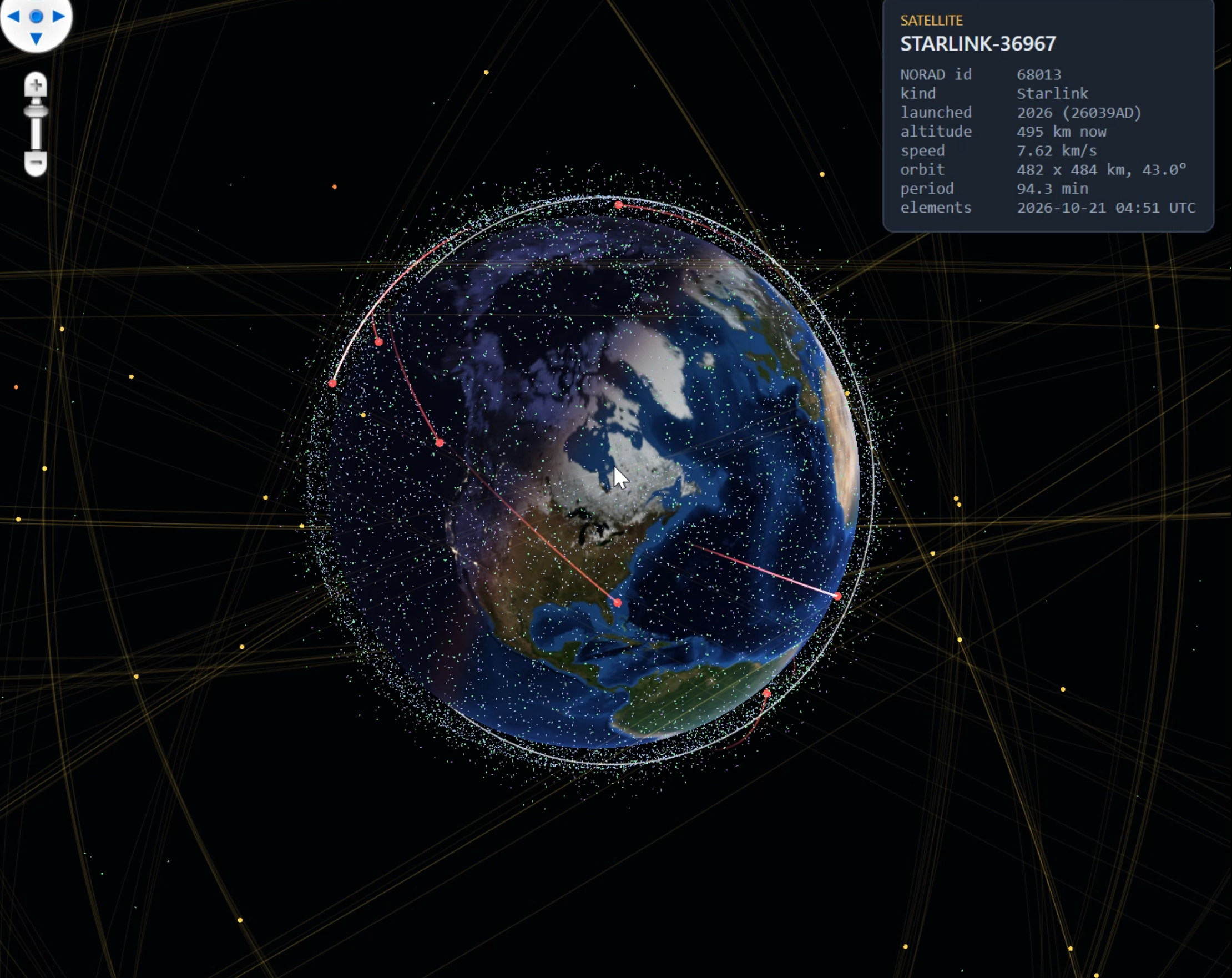
ThinkGeo 15 adds a 3D globe view that can transition into a traditional flat map as users zoom closer to the ground. Developers can also animate transitions between different map projections.
Support includes Robinson, Mollweide, Winkel Tripel, UTM, polar projections, and other coordinate systems.
These capabilities are particularly useful for global-scale visualization, scientific applications, and specialized GIS systems that require projections beyond Web Mercator.
Advanced GPU Data Visualization
The new GPU engine goes beyond traditional map rendering with tools for displaying complex, continuously changing geographic data.
New capabilities include:
Large-dataset heatmaps for visualizing geographic concentrations and density.
Isolines and contour maps for displaying elevation, temperature, pressure, and other measured values.
Grid visualizations with gradients and classified colors.
Animated particle flows for visualizing wind, ocean currents, and other directional data.
Dynamic features for displaying moving vehicles and other frequently updated geographic objects.
These features make ThinkGeo suitable for more demanding visualization applications, including weather analysis, environmental simulations, transportation monitoring, and real-time operational dashboards.
Get Started with ThinkGeo 15
ThinkGeo 15 is a significant step forward in our GIS technology. The new rendering engine and 3D capabilities provide the foundation for a new generation of mapping applications, while improvements to styling, visualization, and licensing make the SDK easier to integrate into modern development workflows.
These are just six of the major changes in version 15. The release also includes improvements to offline mapping, vector tiles, GIS data interoperability, printing, and performance.
For the complete list of changes, see the ThinkGeo 15.0 release notes.
We Welcome Your Feedback
We hope you found today’s post useful. If you have questions or topics you'd like us to cover in future posts, we’d love to hear from you! Email us at sales@thinkgeo.com or schedule a meeting to talk in person. We always enjoy connecting with our customers, learning how you’re using ThinkGeo, and exploring new ways to improve our products.
About ThinkGeo

We are a GIS software company founded in 2004 and located in Frisco, TX. Our clients are in more than 40 industries including agriculture, energy, transportation, government, engineering, IT, and defense.
We pride ourselves on our excellent service and transparency. ThinkGeo offers a variety of products and services to meet almost any GIS application need. We can even help you develop your next project - anywhere from a few hours of consulting to outsourcing an entire project. To learn more, email us at sales@thinkgeo.com, or call us direct at 1-214-449-0330.
