GIS Mapping Made Easy
— Quick and Powerful Cloud, Mobile, Web and Desktop GIS Solutions for Any Industry.
What’s New


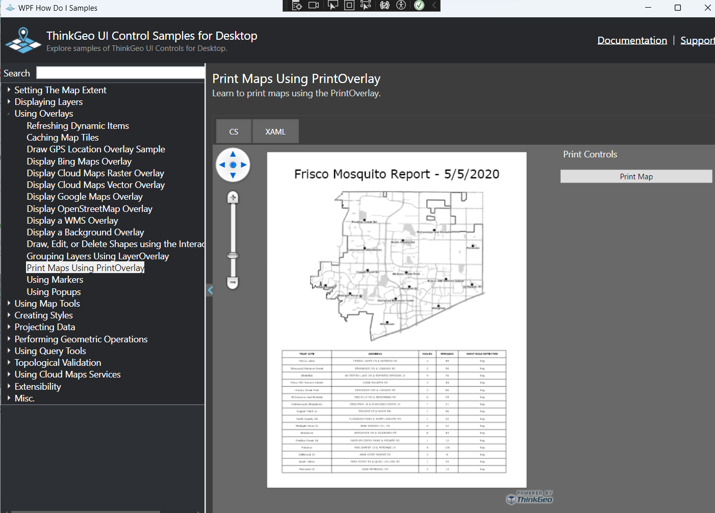


THINKGEO DESKTOP MAPS
Interactive .NET Map Control for WPF and Winforms
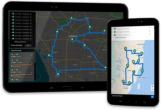
THINKGEO MOBILE MAPS
Interactive Xamarin Map Control for iOS, Android & Xamarin Forms
THINKGEO WEB MAPS
Developer components for Blazor, ASP.NET, and Web API

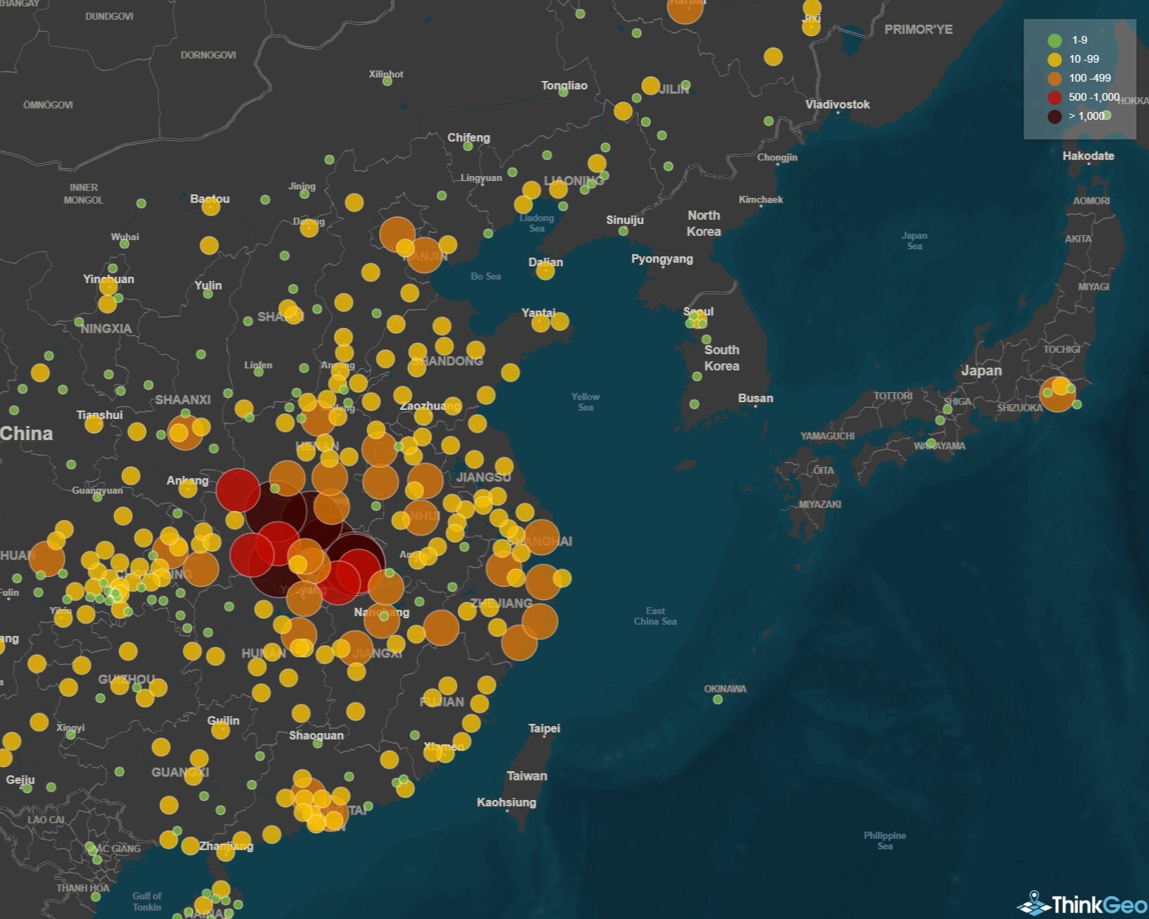
THINKGEO CLOUD MAPS
Cloud-Based Maps and GIS Services
Consulting From Experts
Project Outsourcing
Let our GIS experts build your next great web, mobile or desktop application. Leverage our experience and track record of actually delivering projects to production.
Staff Augmentation
Augment your development team with our GIS experts who know ThinkGeo’s products inside and out. Speed up your development and sidestep expensive mistakes before they happen.
Training & Design
Learn how to use ThinkGeo’s controls directly from its creators. Whether you need on-site or remote training, we can help you and your development team get up to speed with ThinkGeo.